HCSS Plans has long been a go-to digital plans solution for Heavy Civil contractors across North America. HCSS Plans’ innovative Location Services features have allowed field users to see their location directly on the plan sheet. Similar to what you’ve seen in Apple and/or Google Maps, this “blue dot” has allowed project managers to plan faster, field crews to work smarter, and the entire project team to collaborate in new and exciting ways.
HCSS listened to what made this feature successful and has improved on it from direct input from its customers.
“The spark for this menu originally came from a current customer at the annual User Group Meeting. The “blue dot” was saving so many companies time in the field that foremen and superintendents would raise hell when a project wasn’t set up for the blue dot.
By finding out what other questions, issues, or tasks the field needed to do based on their location led to the next big leap forward in our location services.”
– Andrew Fowler, Product Manager, HCSS Plans
Empower Your Foremen to Work Smarter
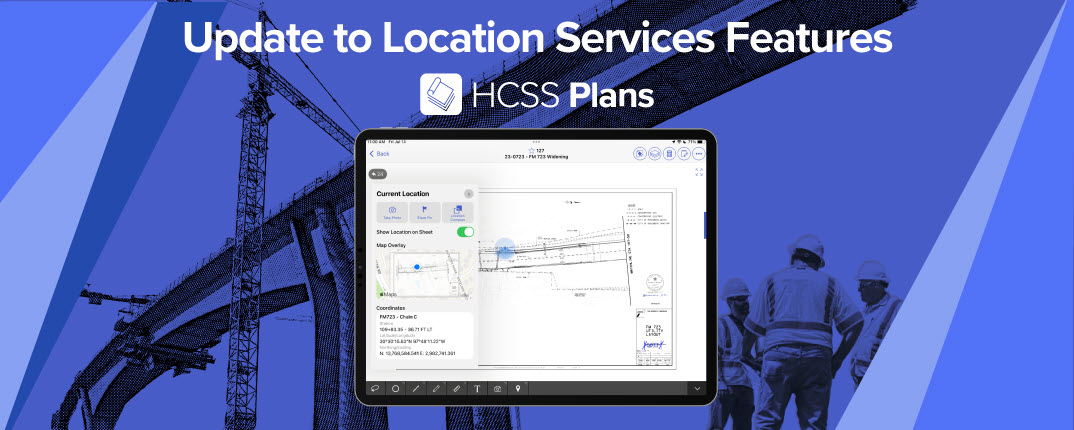
Now, foremen using HCSS Plans on iOS have access to new options and new workflows to make their work even easier. The first innovation is the new Current Location menu. The blue dot helped a project manager by having one crew mark locations with a flag annotation, and the blue dot would help the next crew so they knew when they were close to one of those flags.
However, the project manager noted that if a foreman could quickly see the station he was at, it would speed up their work even more. This idea of speeding up the work even more led to an obsession.
We have long realized at HCSS that the key to success is to empower foremen to document what they needed to as fast as possible and get back to the work that mattered most. The new Current Location menu allows the foreman a one-press solution to quickly photo what they need with the exact location included. This photo is then available to anybody else with access to the project.

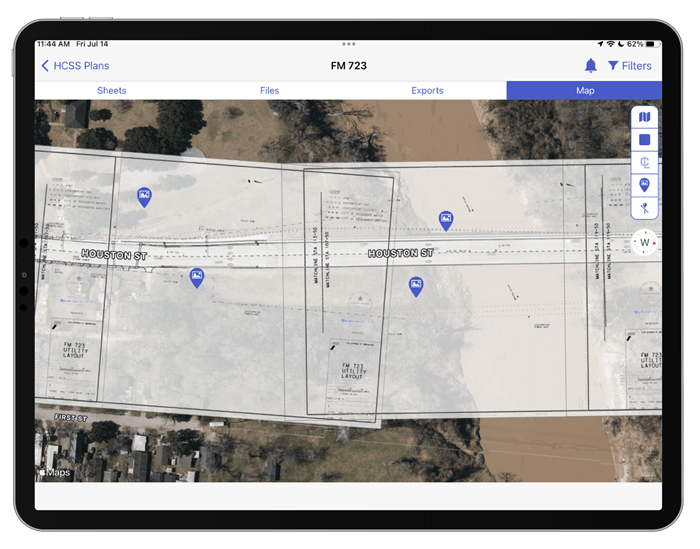
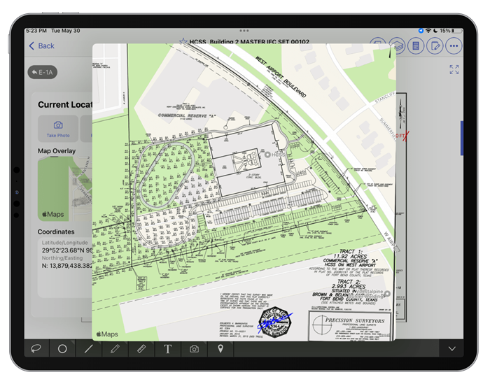
Map Overlay
The Map Overlay quickly aligns the sheet to the map, helping to answer where everything is or should be. And of course, the spark that started it all is there as well. Foremen can see all the relevant coordinates for their location, whether it is the station, longitude and latitude, or the northing and easting.This combination of features is now empowering foremen to do what they’ve long dreamed of doing - work smarter, not harder.
Sheet Stitching Reimagined
In the many years that HCSS has been implementing customers, one thing has stayed the same. In every office, somebody has taken the time to cut and paste plan sheets together to form a single consolidated plan. A lot of the process now has gone digital, but unfortunately, the process is a digitized form of the scissors and glue that was used before.With the new Map option in HCSS Plans, a new way of stitching sheets has been born. Now, every sheet that has been aligned with location services will show up on the Map view in its exact location. That means sheet stitching happens automatically as a part of setting up for location services!